









Science at work 7 October 2026
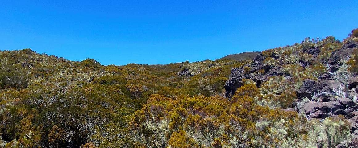
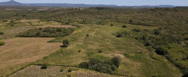
The Grand Bénare mountains in Réunion are home to unique habitats, flora and fauna. They are a UNESCO World Heritage Site © DR
At almost 2900 metres above sea level, the Grand Bénare mountains are home to habitats and species with high heritage value. However, those environments are under many types of pressure, notably from invasive exotic species, fires, erosion or overtourism. The issue is no longer just knowing where habitats to be preserved and degraded zones are: it is now important to decide where to intervene, in which ways and in what order.
The diagnosis of the mountain range was based on extensive fieldwork: 1050 hectares were covered, taking 88 man-days, supplemented by remote sensing data. That combination served to characterise the degree of invasion and to distinguish between intact, less invaded, moderately invaded and highly invaded sectors. However, the novelty lay mainly in how the data were used: the map is not the end result, but a decision support tool.
Right from the start, we wanted the project to produce operational results.
This rationale fits neatly into ReMiNat, a research and innovation project aimed at federating players in Réunion around a spatialised, operational strategy to restore natural environments. In Grand Bénare, it has now truly taken shape: a ten-year programme to steer human and financial resources towards the sectors where they will be of most use. Managers are now implementing part of the programme: the Réunion National Park and the French Forestry Board (ONF) are working on an area of around 1000 ha. Three brigades are crisscrossing the mountains regularly to set up these actions.
The programme translates mapping into grassroots decisions. In as-yet intact or scarcely invaded zones, the priorities are surveillance and prevention. Isolated foci may be surveyed and targeted. In less or moderately invaded zones, there are plans for restoration operations. Lastly, on invasion frontlines, the aim is to stop the spread. In other words, the idea is not to take the same action everywhere, but to adapt efforts to the state of the environment, the dynamics of the invasion, and the feasibility of interventions.
Without operational criteria pinpointed thanks to field operatives, there is a risk of producing scientific results that are not suited to the situation on the ground.
ReMINaT's approach has one central principle: constant dialogue between scientific data, expertise and grassroots realities. Réunion National Park management stresses that "including the different partners in this co-constructed approach serves to build a coherent management strategy on the scale of the mountain range".
This roadmap is being built with the Réunion National Park, ONF, the Mascarin national botanical conservatory, the State, the Regional Council and the Departmental Council, along with CIRAD, the University of Réunion and the other players involved in conserving natural environments. Each partner is contributing its data, expertise, field experience and intervention capacity.
The result is a programme designed to be put into practice: over ten years, with prioritised interventions and a funding requirement currently estimated at between 7 and 12.5 million euros. The plan is also to monitor and assess interventions, continue the diagnosis in zones that have not yet been inventoried, and test new restoration techniques.
This is where the approach comes into its own: data do not stay on a map. They become decisions, and then operations. In Grand Bénare, mapping has now provided a shared roadmap to protect those sectors that are still intact, intervene where invasion is progressing, and restore the most degraded environments. This is a very concrete way to apply research: in the choices made by managers, in resource planning, and, in future, in restoration operations.
The ReMiNat project fits into a broader partnership to manage and restore priority environments in Réunion. Numerous structures, both public and private, are working to restore Réunion's ecological heritage.
In 2018, the State, the Departmental Council, ONF, the Mascarin national botanical conservatory (CBN-CPIE Mascarin), the Directorate for the environment, land use planning and housing (DEAL Réunion), CIRAD in Réunion-Mayotte-Indian Ocean, the University of Réunion and the Réunion National Park set up a working group to identify 55 000 ha of zones with conservation issues, including more than 5000 ha requiring priority management and restoration operations.
In addition to the R&D aspect, the approach covers the range of topics required to build a regional policy to restore at-risk habitats.
Science at work 7 October 2026
Science at work 30 September 2026
Science at work 23 September 2026