Call to action 25 November 2025
- Home
- CIRAD news
- News
- Mining and forestry concessions on Saamaka territory in Suriname
Deforestation in Suriname: the contradictions of the “greenest country in the world”

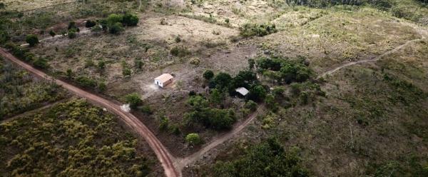
Access road to land or mining concessions in Suriname, opened through the forest © Bram Ebus, ILC
Suriname is recognised as a global leader in forest preservation. The country has succeeded in conserving 93% of its forest cover and regularly renews its international commitments to combat deforestation. However, despite touting itself as the “greenest country in the world”, the government of Suriname continues to grant forest and mining concessions to international companies, resulting in significant land degradation. Moreover, these concessions are sometimes located on the territories of indigenous and Afro-descendant communities, which are nevertheless protected by several international and inter-American laws.
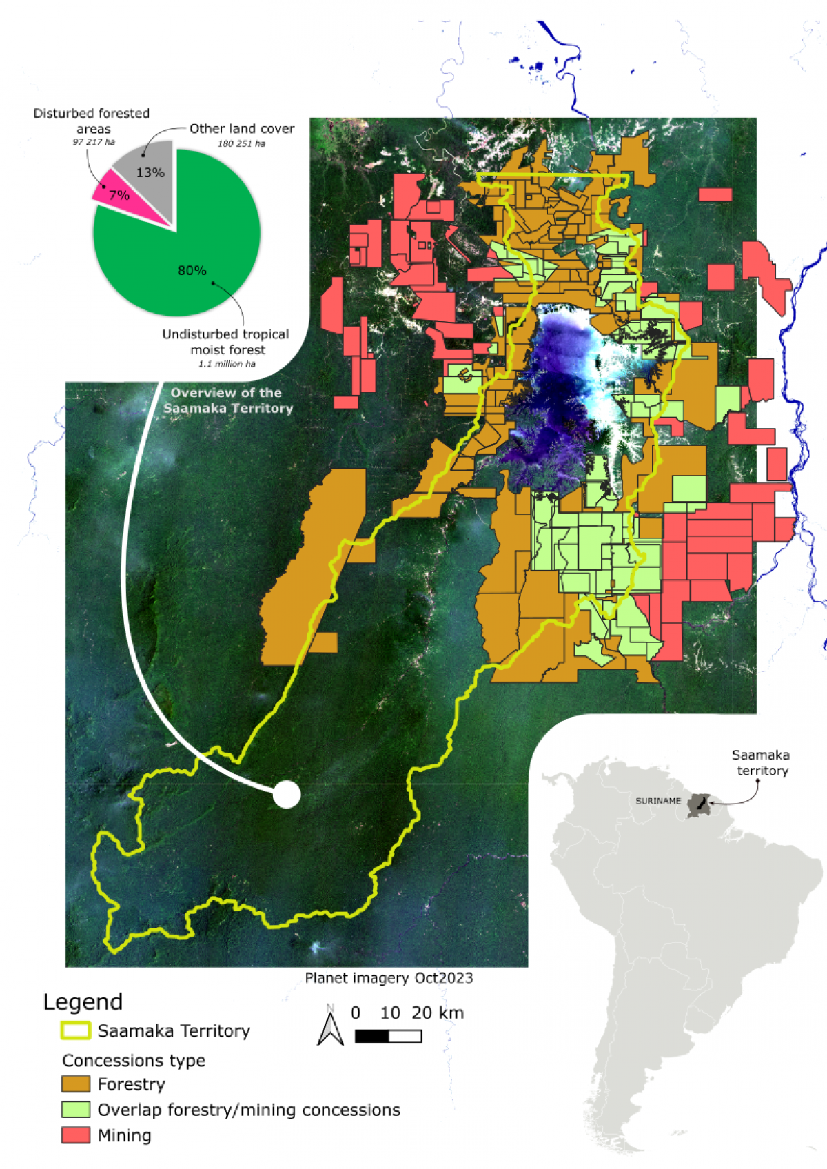
In a new report, the International Land Coalition (ILC) and its partners (including CIRAD) describe the evolution of concessions on Saamaka territory and their impact on the forest. At the end of June 2024, a part of the Saamaka people protested against the illegality of these concessions in light of the decisions made by the Inter-American Court of Human Rights (IACHR). On this occasion, they presented the report to the President of Suriname, the Vice-President, the President of the National Assembly and Members of Parliament in the hope that their alarm call will yield results.
“The ILC works at the international level, but the data produced by the coalitions of partners can be applied on a smaller scale, and particularly at the territorial level”, says Jérémy Bourgoin, a geographer at CIRAD and co-author of the report. “The case of the Saamaka illustrates the amplifying role that international organisations can play and the need to democratise access to and use of data to support advocacy for the rights of local communities”.
Illegal concessions are still being granted
In 2007, the Inter-American Court of Human Rights ordered the government of Suriname to delimit the territory of the Saamaka, one of the country’s six tribal peoples, making up 20% of its population. The Saamaka are Afro-descendants whose ancestors escaped slavery by hiding in the jungle. As indigenous peoples, the Saamaka preserve the forest and its rich biodiversity and are at the forefront of the fight against deforestation.
The Saamaka territory has been delimited, but the government does not respect its boundaries and continues to award parts of these protected lands, even though the Inter-American Court of Human Rights ordered a complete halt to concessions. Since 2007, more than 40 000 hectares of forest have been disturbed (degraded or deforested). According to the International Land Coalition report, forest concessions are responsible for 53% of degradation and deforestation on Saamaka territory.
Local communities have repeatedly requested the implementation of free, prior and informed consent. They are also demanding explanations on the state’s decision to grant these areas to private companies and on potential benefit sharing. They have received no information about the decision itself or about the impact these concessions could have on their daily lives. The private companies that have been granted land include Palmera Hout (29 000 hectares of forest concessions), Western Paragon (29 000 hectares of forest concessions), Fuerte Juntos (4 000 hectares of forest concessions), Nuestra Tierra (3 000 hectares of forest concessions), Dorado Resources (mining, number of hectares unknown), Loyalty Natural Resources (mining, number of hectares unknown) and Sarakreek Minerals Development (mining, number of hectares unknown).
The ILC encompasses various projects and observatories on land access and ownership. To produce this report, the authors used data from the Land Matrix initiatives, which focus on large-scale land investments and the LandMark project, which maps indigenous territories throughout the world. Satellite analyses by the World Resources Institute’s Global Forest Watch and data from the Joint Research Centre’s Tropical Moist Forest observatory underpinned the analysis of forest disturbance trends.
