


Results & impact 10 July 2026
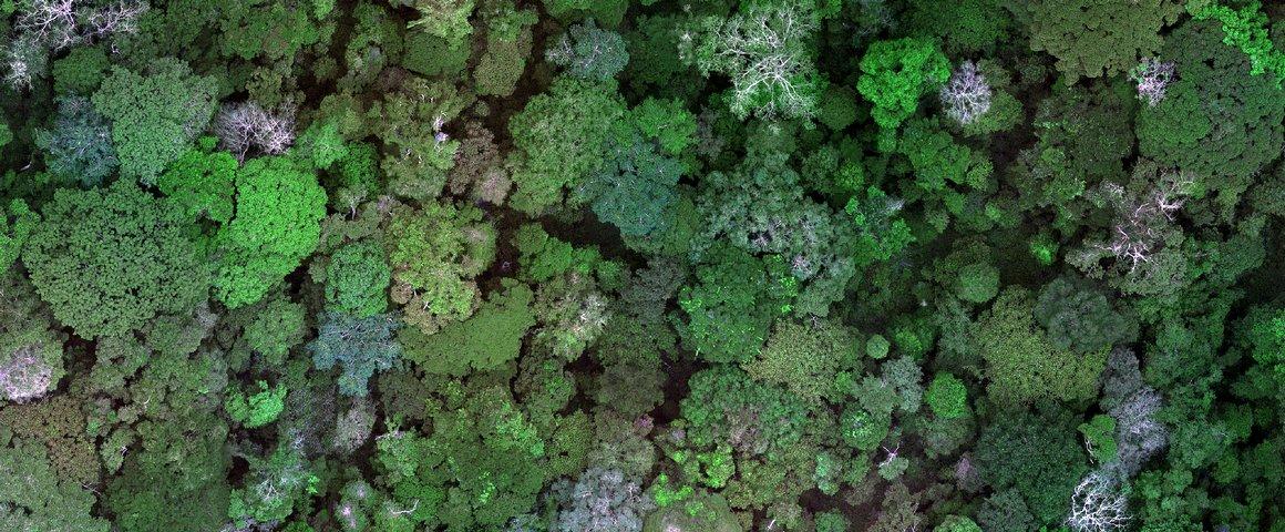
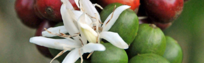
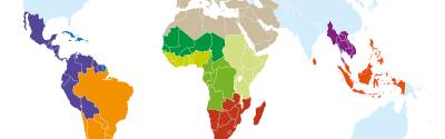
The new EU regulation will mean an EU-wide ban on products associated with deforestation or forest degradation since 31 December 2020 © V. Gond, CIRAD
"It is CIRAD's field knowledge that allows it to take part in this type of exercise", says CIRAD's Valéry Gond, a geographer and co-author of the work led by the EU Joint Research Centre. He specializes in analysing satellite and drone data to map tropical forests and understand how they function. "The JRC team called upon my photo-interpretation expertise, because I have been involved in field geography for 25 years now."
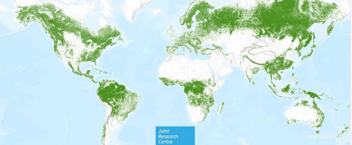
The JRC had already been producing global vegetation maps every five years since 2000. This year, its work centred on forests, to support the EU Regulation on Deforestation-free Supply Chains (EUDR). The new map is a harmonized, globally-consistent representation of where forests existed in 2020. It has a spatial resolution of 10 m.
© OpenStreetMap (and) contributors, CC-BY-SA; TomTom, FAO, NOAA, ESRI, USGS
The new EU regulation will mean an EU-wide ban on products associated with deforestation or forest degradation since 31 December 2020. It was published on 29 June 2023 and will apply to all member States as of 30 December 2024.
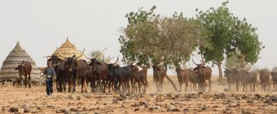
The map will help operators determine whether a commodity (beef, cocoa, coffee, palm oil, rubber, soybean and wood) or by-product imported into or exported from the EU market was produced in zones that have been deforested since 2020. The map could also help the relevant authorities identify areas to carry out checks and adjust their implementation efforts, for instance by acquiring and interpreting very high spatial resolution imagery.
The JRC is currently assessing the feasibility of mapping forest degradation with sub-classes of forest cover, as per the definition in the EU Regulation on Deforestation-free Supply Chains. "We are working with the JRC on these ideas, and on plans for maps that would change over time", Valéry Gond points out. "More specifically, we are looking at patches where trees have been felled, since they serve to locate, quantify and characterize different types of legal and illegal logging operations, in order to monitor and control those activities."
Results & impact 10 July 2026
Results & impact 19 May 2026
Results & impact 20 April 2026