
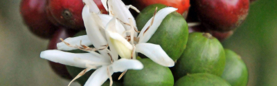
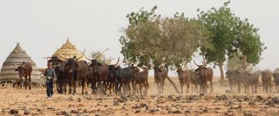
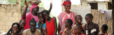


Science at work 7 July 2026
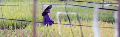
Whereas Brazil's Para state saw a 25% increase in deforestation in 2020, the municipality of Paragominas, in the heart of the state, reported the lowest deforestation figures in its history. CIRAD and its partners are working there to reconcile productive agriculture and forest conservation policies © R. Poccard-Chapuis, CIRAD
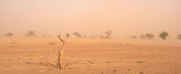
In 2015, the municipality of Paragominas in Brazil was hit by a series of devastating fires: 183 000 hectares of forest went up in smoke. That loss, over just a few months, was as devastating as the total deforestation over the previous 15 years. While such vast forest fires are now a rarity in Paragominas, the overall trend in the Amazon and worldwide is upward. Decades of deforestation and degradation have seriously affected ecosystems and made the forest increasingly vulnerable to drought, hence to fires.
183 000 hectares of forest went up in smoke in 2015 in Paragominas (Brazil) © R. Poccard-Chapuis, CIRAD
To fight this growing risk and preserve the forest without sacrificing economic and social development, CIRAD researchers are working to help local stakeholders manage their territory better. The aim is to rethink the spatial organization of local landscapes, combining farmland and forest areas, depending on the specific capacities of the on-site environment. "The spatial distribution of land use types plays a critical role in productivity, the water cycle and water quality, nutrient recycling and flows, carbon storage, biodiversity and pest control" , says René Poccard-Chapuis, a geographer with CIRAD who is coordinating the Paragominas pilot as part of the TerrAmaz project aimed at reconciling sustainable agricultural transition, forest preservation and social inclusion.
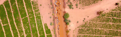
A map of zones suitable (or not) for sustainable intensification of crop and livestock systems is being drawn up, with a series of indicators to assess the sustainability of territorial development methods.
For the Mayor of Paragominas, Paulo Pombo Tocantins, the challenge is not fighting deforestation, which is now under control, but "to organize landscapes in an efficient way, depending on the capacities of the local land : suitability for intensified agricultural production and capacity for forest cover to protect soils effectively, protect the water cycle, conserve biodiversity, and store carbon". A land use act is currently being drafted for the municipality.
In this photo, terraces are being constructed to prevent soil erosion, while forests occupy any areas that are not flat © R. Poccard-Chapuis, CIRAD
CIRAD is working with local stakeholders to help the municipality to identify zones. "In zones that have already been deforested, we suggest sustainable farming practices that boost crop yields", René Poccard-Chapuis explains. "Instead of intensification by means of chemical inputs, we encourage a transition to ecologically intensive practices." The past few years have seen the development in Paragominas of new pasture management practices, mechanized crops such as maize, sorghum or soya, several tree crops (cocoa or fruit trees), and agroforestry systems.
Agroforestry practices boost soil fertility, reduce erosion, foster pollination, create habitats for biodiversity, increase carbon storage, etc. They also reduce the risk of fires during the dry season, thanks to the moisture released into the atmosphere through evapotranspiration © R. Poccard-Chapuis, CIRAD
"We also encourage people to leave zones not suitable for agriculture to lie fallow, and we are measuring the effects on water and carbon cycles and on biodiversity." In such zones, crop and livestock farming have thus been abandoned and the forest is growing back at a speed that depends on the history of the plot concerned (for instance the degree of soil compaction) and the landscape configuration (proximity to trees likely to spread). According to Lilian Blanc, a forest ecologist with CIRAD, "the development of these new forests, called secondary forests, is not just intended to increase the area of forest in the municipality, but should also help to boost certain ecosystem services, such as limiting soil erosion or linking forests".
To organize landscapes more efficiently, areas not suitable for agriculture are being abandoned and forest cover is gradually being restored. This enables forest corridors to reconnect with the forest matrix © R. Poccard-Chapuis, CIRAD
If this combination of agricultural intensification and forest restoration is working in Paragominas, it is because farmers are no longer trying to increase the utilized agricultural area of their farms. Paragominas is the first municipality in Brazil to have introduced an official land register for almost its entire territory, enabling systematic farm monitoring, among other things. National satellite monitoring and coordination between the local authorities and value chains mean the police can now identify the people responsible for any new deforestation, and prevent them selling the resulting products.
"By preventing further deforestation, the authorities are indirectly forcing farmers to adapt and intensify production on the agricultural areas they already have", René Poccard-Chapuis observes.
This work - conducted in collaboration with EMBRAPA, Pará State University and the Federal Rural University of the Amazon - opens up new prospects for the territory, for instance the construction of a territorial sustainable development label or the establishment of a "zero deforestation" supply area for responsible value chains.
The EMBRAPA campus, the Brazilian agricultural research centre hosting CIRAD in Paragominas, is conducting agroforestry trials (foreground) that serve as demonstration plots for farmers. In the background, a fire-damaged forest block has been restored and acts as a sustainable forestry resource management "laboratory" © R. Poccard-Chapuis, CIRAD
The municipality of Paragominas was chosen as one of five innovative models being studied by the TerrAmaz project. During the course of the project, funded by AFD, CIRAD and its partners will be studying and supporting the rollout of this type of approach aimed at reconciling sustainable agriculture and forest resource conservation in the Amazon. "A territorial certification approach is due to be developed in Paragominas to assess the progress made by committed territories, promote them and step up responsible investment", says project leader Marie-Gabrielle Piketty.
The figures for deforestation in the Brazilian Amazon: a very contrasting picture The figures reported by the INPE show a loss of 11 088 square kilometres of forest across the Brazilian Legal Amazon between August 2019 and July 2020. This is the highest figure since 2008 and the third yearly increase in a row since 2017: 8% in 2018, 25% in 2019 and almost 10% in 2020. According to CIRAD's René Poccard-Chapuis, "the increase in deforestation in the "legal" Amazon in fact hides substantial geographical variations. There is an Amazon in which deforestation is increasing much faster than elsewhere, and an Amazon that has put a stop to deforestation". In fact, the rise of almost 10% observed in 2020 (corresponding to 959 km2 across the Brazilian Amazon) is concentrated in Pará state alone. The situation in other states is more or less stable, with some slightly positive (Amazonas, Mato Grosso) and others that are either slightly negative or stable. "On a municipality level, just a very small number, in Pará state, are responsible for a major share of deforestation", René Poccard-Chapuis adds. The two municipalities of Altamira and São Félix do Xingú alone account for more than 30% of the deforestation in Pará. Some municipalities, such as Paragominas, on the other hand, are sustaining very low levels of deforestation: 10.75 km2 in 2020, according to the initial figures from the INPE. |
'Municipios Verdes': from zero deforestation to the sustainable management of natural resources in the Brazilian Amazon . In: Living territories to transform the world. 2017. Caron Patrick (ed.), Valette Elodie (ed.), Wassenaar Tom (ed.), Coppens D'Eeckenbrugge Géo (ed.), Papazian Vatché (ed.). Versailles: Editions Quae, 54-57.
Science at work 7 July 2026

Science at work 17 June 2026
Science at work 20 May 2026