


Results & impact 20 April 2026
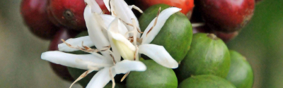
The dense rainforests of Central Africa, the world’s second largest expanse of tropical forest after the Amazon, are some of the least known on the planet. Scientific mechanisms for inventories and monitoring of forest dynamics – within which trees are measured, identified and monitored over time – only cover, in cumulative area, a few hundred hectares in the region, thereby limiting our understanding of the diversity and functioning of the forests found there.
Although scientific forest inventories are scarce, management inventories conducted in forest concessions are less so. Indeed, the Central African countries have gradually modified their forest policies since the Rio Summit in 1992. In particular, they now require forestry companies to inventory resources and to implement sustainable management plans in their concessions. It is estimated that in 2019, 58% of the 50 million hectares of forest allocated to loggers were inventoried in this part of the world. This wealth of data is nevertheless disregarded by the scientific community, particularly because the inventory protocols followed by forest operators do not correspond to the standards for conventional scientific inventories.
However, for almost 20 years, CIRAD has been working with consultancies and dozens of forestry companies in Central Africa. With their participation, it has thus designed and delivered a regional database of management inventories. Named CoFor (Congo Basin Forests), this database contains data from 100 000 hectares of inventories, or around 12 million trees measured and identified in five countries. In person-years, this corresponds to 1000 years of data collection.
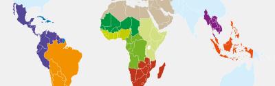
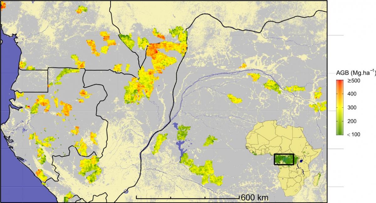
These data cover areas that will never be matched by scientific inventories. Thanks to a rigorous approach and an original analysis method developed by CIRAD and IRD, they have enabled the creation of a second database, CoFor-AGB*. This database provides reliable estimations of forest carbon for almost 60 000 observations in 1-km2 plots, with an uncertainty similar to that obtained from scientific inventories. The carbon stock estimated in the context of this analysis ranges, for 95% of observations, between 115 and 485 tonnes per hectare. The highest values observed are in a region stretching from central Gabon to some parts of the Central African Republic in the extreme north of the forest area, via southeastern Cameroon and northern Congo.
CoFor-AGB is thus an exceptional source of data that can serve as a reference for future analyses, especially scientific ones, on tropical rainforests and biomass stocks at the global level. It has already served to calibrate models aimed at mapping biomass across the whole Central African dense forest area. It could also be used by the countries in the region wishing to improve estimations of CO2 emissions associated with forest disturbances in the context of projects under the international initiative REDD (Reducing Emissions from Deforestation and Forest Degradation).
* AGB: Aboveground Biomass
Ploton, P., Mortier, F., Barbier, N. et al. A map of African humid tropical forest aboveground biomass derived from management inventories. Sci Data 7, 221 (2020)
Results & impact 20 April 2026
Results & impact 13 March 2026

Results & impact 28 October 2025