


Results & impact 29 June 2026
.jpg)
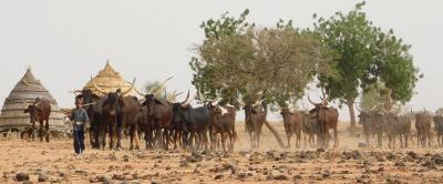
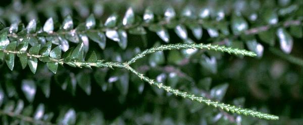
At the global level, 17% of tropical moist forests have disappeared in favour of agriculture and other land uses since 1990 © V. Gond, Cirad
According to the findings of this work, the last three decades saw the loss of 220 million hectares of tropical moist forest. “The satellite data show us that, between 1990 and 2020, around 7 million hectares of tropical moist forest disappeared on average yearly. This is equivalent to roughly the size of Ireland, every year” , says Ghislain Vieilledent, an ecologist at CIRAD specialising in tropical forests, and co-author of the article.
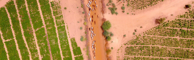
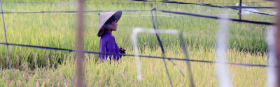
The study reveals that deforestation has been largely underestimated by previous studies, in particular on the African continent. In Africa, the deforestation associated with slash-and-burn agriculture forms a patchwork, affecting small but numerous forest areas, which makes it more difficult to detect by satellite. At the global level, 17% of tropical moist forests have disappeared in favour of agriculture and other land uses since 1990 . In 2020, there were 1070 million hectares of tropical moist forest throughout the world, compared to 1290 million hectares in 1990.
Moreover, the tropical forests that remain are highly degraded. Tropical forest degradation, which is characterised by the temporary loss of forest cover, is mostly associated with logging, small fires and natural disturbances such as storms. Of the 1070 million hectares of tropical moist forest remaining in 2020, 10% are degraded forest and are at high risk of deforestation in the near future. Indeed, almost half of all degraded forests are subsequently deforested. And the situation seems to be accelerating, as noted by Christelle Vancutsem, a specialist in remote sensing at JRC and lead author of the study: “Over the five years from 2015 to 2019, we saw a significant increase in forest degradation: an additional 2.6 million hectares in relation to the period 2010-2014” . This trend is explained in particular by specific climate conditions (droughts and fires associated with the El Niño effect).
Deforestation and forest degradation are a major threat to the climate and biodiversity. “The conversion of forests to agricultural uses is the second largest source of atmospheric CO2 emissions after fossil fuel combustion”, says Ghislain Vieilledent.
This study documents, for the first time at the pan-tropical scale and over a 30-year period, the extent of tropical moist forest cover and its changes. High spatial resolution maps (30 m) provide annual information on the degradation, deforestation and regeneration of tropical moist forests over the period 1990-2019. In particular, this is the first time that degradation has been differentiated from deforestation at such a large scale. The degree of accuracy of the maps obtained makes it possible to differentiate the causes of deforestation or forest degradation: agriculture, logging or forest fires. The map of annual forest cover change over the period 1990-2019 is available to the scientific community and the general public, at https://forobs.jrc.ec.europa.eu/TMF/.
For the authors of the article, this work on tropical moist forest cover change at the global scale is essential to support policies to halt deforestation and to protect biodiversity. The findings and outputs of this study could therefore be used at the global, national or regional level to improve the management and conservation of tropical moist forests. Ultimately, the findings of the study will help to better quantify the contribution of tropical forests to global carbon fluxes.
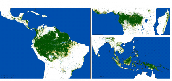
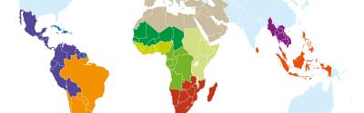
Map of tropical moist forests remaining in January 2020 (by continent) © Science Advances, Vancutsem et al. 2021.
Map of tropical moist forests remaining in January 2020 (by continent) © Science Advances, Vancutsem et al. 2021.
Vancutsem C., F. Achard, J.-F. Pekel, G. Vieilledent, S. Carboni, D. Simonetti, J. Gallego, L. Aragao and R. Nasi. 2021. Long-term (1990–2019) monitoring of forest cover changes in the humid tropics. Science Advances (Sci. Adv.) 2021; 7: eabe1603
Results & impact 29 June 2026

Results & impact 24 June 2026
Results & impact 3 February 2026