


Science at work 7 July 2026
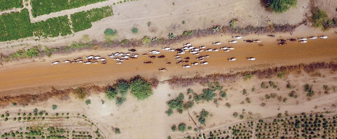
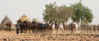
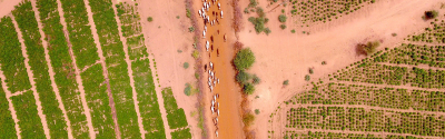
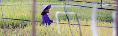
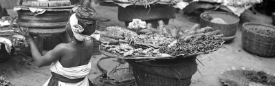
Movement of livestock between cultivated fields, Senegal River delta © J. Bourgoin, CIRAD
Through surveys conducted in more than 1 000 camps across 6 000 km² around the Senegal River Delta, the authors of the study published in Land Use Policy have assessed the role of pastoral activities, highlighted their demographic importance and identified the main routes used by nomadic herders. The simple and easily replicable technique indicates the broad patterns observed in the region.
Almost five times more cattle and goats, and seven times more sheep than in sedentary livestock systems: nomadic livestock systems in this part of Senegal play a major role in meat and dairy production in the country. This is shown by the routes travelled by herds, most of which are linked to meat and dairy markets. Contrary to sedentary systems, pastoral activities are also more sustainable: they are mostly carbon neutral, and adapt to the difficult climate conditions by using more resistant local species, thereby fostering biodiversity within livestock systems.
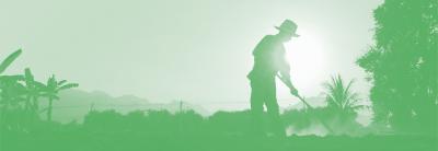
“Pastoralism is one of the pillars of food security for many rural populations, as well as being an activity adapted to their environment”, says Jérémy Bourgoin, a researcher at CIRAD and co-author of the study. “Despite the opportunities provided by these nomadic systems, they are largely invisible in the eyes of policymakers and investors”.
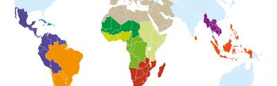
Although they were shown on maps from the 1950s, pastoral dynamics began disappearing from official geographical representations from the 2000s onwards. New maps simply show the circulation areas for access to watering points, but these are only theoretical and are not actually implemented.
“Current maps focus on sedentary agricultural activities, especially large irrigated farms”, says Jérémy Bourgoin. “For example, they cover cereal and horticultural production, some of which is aimed at the export market”.
One of the arguments to explain the lack of representation of pastoral activities is the technical difficulty of collecting the necessary data. Through the study, Jérémy Bourgoin’s team has shown on the contrary that the technical barriers are limited. However, field surveys require certain financial and human investments. This investment is essential, according to the scientist: “If public and economic actors want to implement fair, equitable and sustainable planning, then they cannot acknowledge only some agricultural activities. Failing to represent pastoral activities will not make them disappear, but will be a source of tension in the field”.
With the increase in rainfed agriculture and the expansion of intensive irrigated farms into the routes travelled by nomadic herders, the scientists fear mounting tension over access to land and watering points. One of the solutions put forward involves investing in the deployment of territory-based approaches to multi-use land planning. Going beyond a simple analysis or a superficial consultation, efforts must therefore be made to implement participatory planning processes, to ensure these guarantee the long-term coexistence of different activity systems and lifestyles. The research conducted in the context of the Health & Territories project, for example, is a step in this direction.
The scientists believe that these policy trade-offs will be possible thanks to access to up-to-date knowledge and data on territorial dynamics, such as the cartographic representation of certain pastoral activities: “Maps are instruments of power that are essential to planning and to public development policies”, says Jérémy Bourgoin. “By making pastoral activities more visible, we hope that they will be given greater consideration in public action”.
Jeremy Bourgoin, Djibril Diop, Labaly Touré, Quentin Grislain, Roberto Interdonato, Mohamadou Dieye, Christian Corniaux, Julien Meunier, Djiby Dia, Sidy M. Seck. 2022. Beyond controversy, putting a livestock footprint on the map of the Senegal River delta. Land Use Policy
Science at work 7 July 2026

Science at work 17 June 2026
Science at work 20 May 2026